Please be advised that due to the upcoming holiday season, delivery times may be extended as courier services experience increased volumes. We appreciate your patience.


Please be advised that due to the upcoming holiday season, delivery times may be extended as courier services experience increased volumes. We appreciate your patience.
+1 (724) 923-6024
📩 Digital product.
The license key will be delivered by email within 24 hours after purchase.
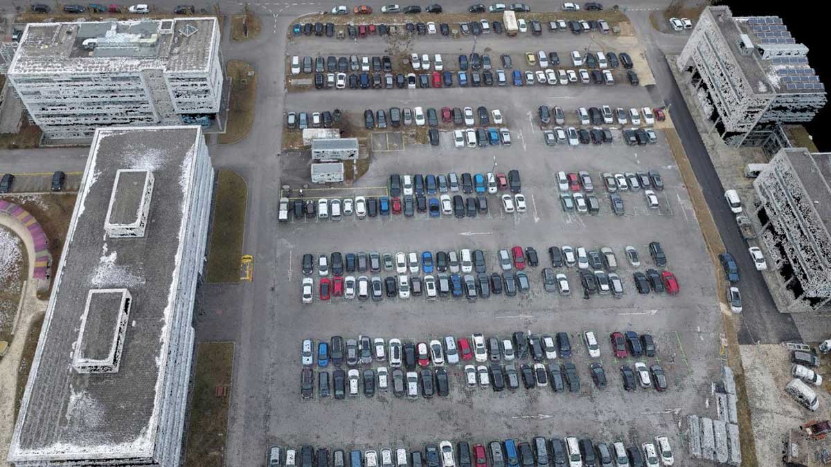
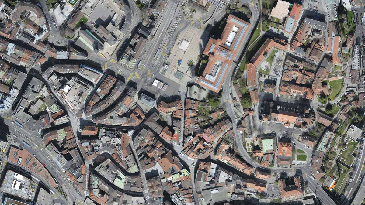
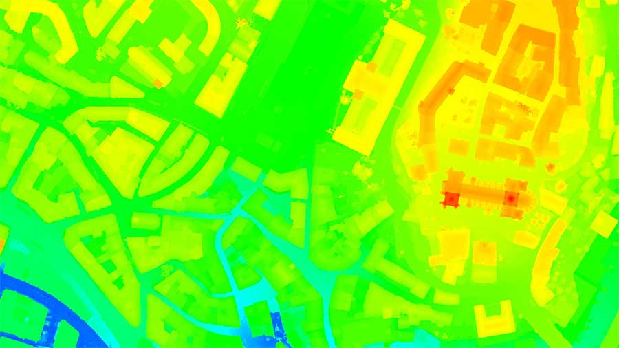
PIX4Dmatic, the next-generation photogrammetry software, is designed to work with the latest generation of drones and transform your large number of images into accurate point clouds, DSMs and orthomosaics over 40% faster than ever before.
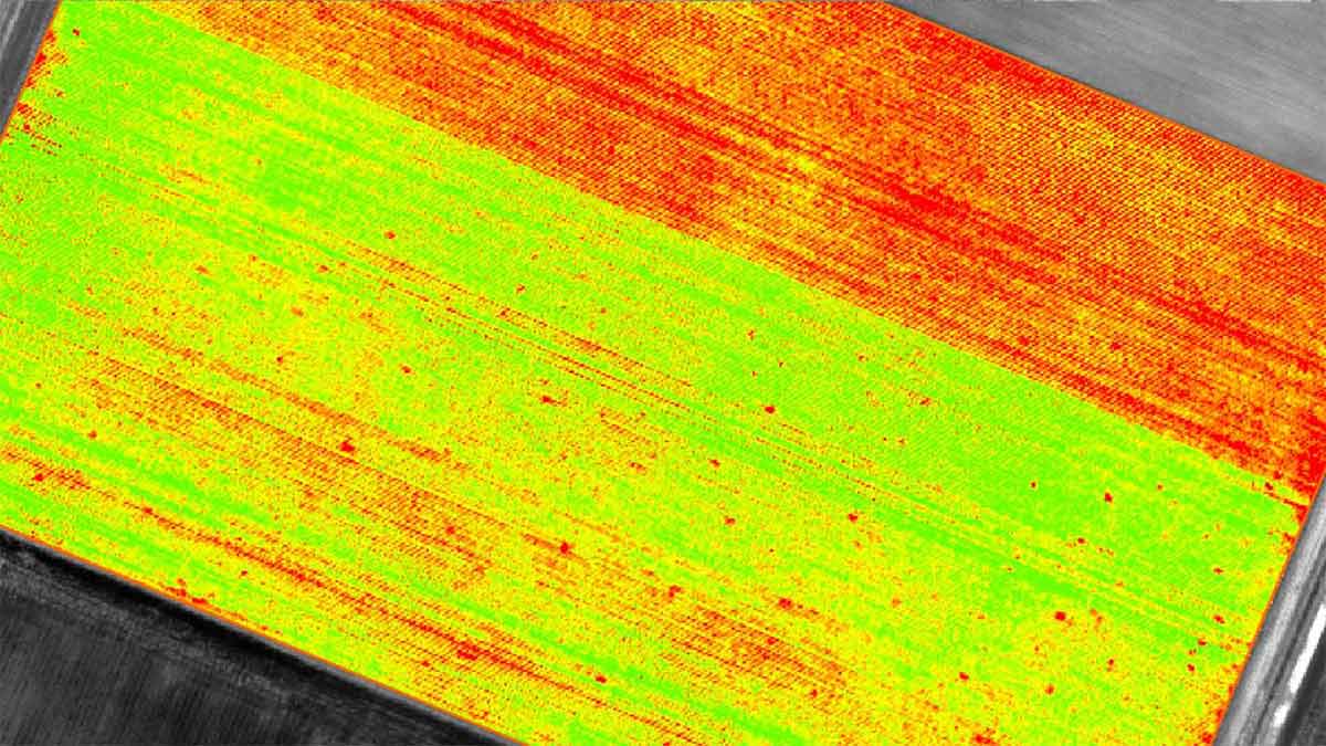
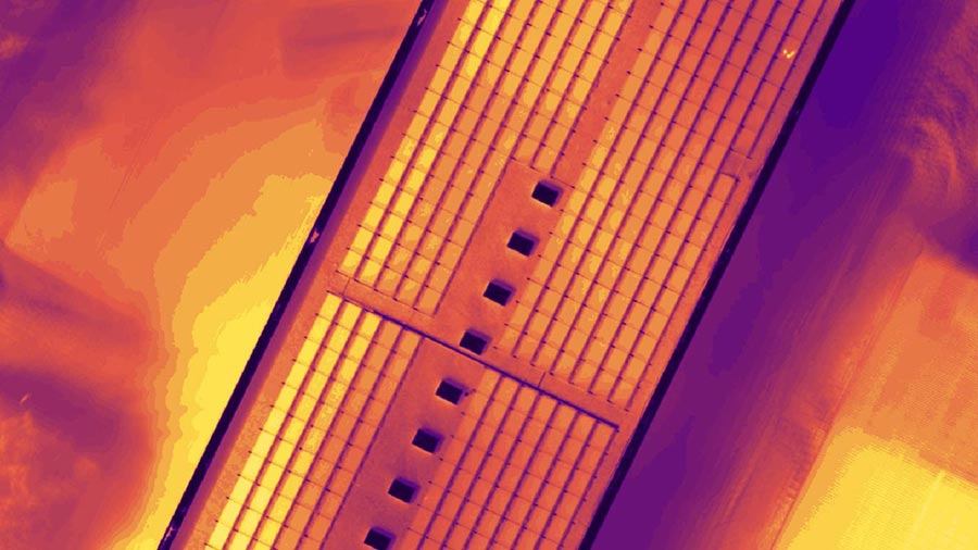
Pix4Dmapper is the leading photogrammetry software that offers an innovative and user-friendly platform for professional drone mapping and spatial data analysis. This advanced software is designed to capture and process RGB, thermal, or multispectral images from any camera, making it a versatile tool for a wide range of applications.
With Pix4Dmapper, educators and researchers can automate flight and image-data transfer using the free Pix4Dcapture app, ensuring a seamless workflow from data acquisition to analysis. The software's high-quality processing capabilities allow users to transform images into detailed digital spatial models, either using the cloud or the desktop photogrammetry platform for ultimate flexibility.
The software provides complete control over your project, enabling you to define areas of interest, select processing options, and integrate ground control points for enhanced accuracy. Pix4Dmapper's advanced rayCloud environment connects original images to each point of the 3D reconstruction, allowing for visual verification and improvement of project accuracy.
Measurements and inspections are made easy with Pix4Dmapper's tools for measuring distances, areas, and volumes, as well as extracting elevation profile data and performing virtual inspections. Collaboration and data sharing are streamlined, with the ability to selectively and securely share project data and insights with your team, clients, and suppliers.
Pix4Dmapper supports inputs from various sources, including aerial nadir and oblique imagery, terrestrial imagery, and video formats. It is compatible with any camera type, from compact to DSLR, and supports multi-camera projects, RTK/PPK + IMU data, and camera rigs.
The software's processing capabilities are robust, featuring automatic aerial triangulation, point cloud densification, and machine-learning classification for accurate 3D maps and models. Quality reports provide a comprehensive assessment of project accuracy and quality, and the software supports project merging, splitting, and area definition for efficient processing.
For educators, Pix4Dmapper elevates the teaching of photogrammetry principles through its unique rayCloud environment. The software enhances curriculums with an extensive knowledge base, open-access online exercises, and videos, making it an invaluable tool for advancing research and education in photogrammetry.
In summary, Pix4Dmapper stands out as a durable and high-quality educational software that offers perpetual licensing for long-term use on up to two devices. Its comprehensive suite of tools and compatibility with various data inputs make it the software of choice for professionals seeking to leverage the power of photogrammetry in their educational and research endeavors.
📩 Digital product.
The license key will be delivered by email within 24 hours after purchase.
PIX4Dmatic, the next-generation photogrammetry software, is designed to work with the latest generation of drones and transform your large number of images into accurate point clouds, DSMs and orthomosaics over 40% faster than ever before.
Pix4Dmapper is the leading photogrammetry software that offers an innovative and user-friendly platform for professional drone mapping and spatial data analysis. This advanced software is designed to capture and process RGB, thermal, or multispectral images from any camera, making it a versatile tool for a wide range of applications.
With Pix4Dmapper, educators and researchers can automate flight and image-data transfer using the free Pix4Dcapture app, ensuring a seamless workflow from data acquisition to analysis. The software's high-quality processing capabilities allow users to transform images into detailed digital spatial models, either using the cloud or the desktop photogrammetry platform for ultimate flexibility.
The software provides complete control over your project, enabling you to define areas of interest, select processing options, and integrate ground control points for enhanced accuracy. Pix4Dmapper's advanced rayCloud environment connects original images to each point of the 3D reconstruction, allowing for visual verification and improvement of project accuracy.
Measurements and inspections are made easy with Pix4Dmapper's tools for measuring distances, areas, and volumes, as well as extracting elevation profile data and performing virtual inspections. Collaboration and data sharing are streamlined, with the ability to selectively and securely share project data and insights with your team, clients, and suppliers.
Pix4Dmapper supports inputs from various sources, including aerial nadir and oblique imagery, terrestrial imagery, and video formats. It is compatible with any camera type, from compact to DSLR, and supports multi-camera projects, RTK/PPK + IMU data, and camera rigs.
The software's processing capabilities are robust, featuring automatic aerial triangulation, point cloud densification, and machine-learning classification for accurate 3D maps and models. Quality reports provide a comprehensive assessment of project accuracy and quality, and the software supports project merging, splitting, and area definition for efficient processing.
For educators, Pix4Dmapper elevates the teaching of photogrammetry principles through its unique rayCloud environment. The software enhances curriculums with an extensive knowledge base, open-access online exercises, and videos, making it an invaluable tool for advancing research and education in photogrammetry.
In summary, Pix4Dmapper stands out as a durable and high-quality educational software that offers perpetual licensing for long-term use on up to two devices. Its comprehensive suite of tools and compatibility with various data inputs make it the software of choice for professionals seeking to leverage the power of photogrammetry in their educational and research endeavors.
Couldn't load pickup availability


